Friday, 12 February 2016

South to Georgetown, Exuma's.


     Over the last month we have continued to travel south down the Exuma chain of Islands. Here are a few pictures of the Islands and anchorages we have visited.


Looking south down Cambridge Cay with Bell Rock.


Looking over to Bell Harbour. Zooropa is in there somewhere.
Looking North, Warderick Wells


North mooring field, Warderick Wells


House and garden on Staniel Cay 


Staniel Cay 

The Blue Grocery Store, Staniel Cay 


Feeding time for the Nurse Sharks, Staniel Cay  

Reefs off the Eastern shore of Staniel Cay 


Black Point Settlement, Great Guana Cay 

Black Point Settlement, Great Guana Cay 


Excellent laundry facilities, Black Point.  

Low tide, Eastern shore of Stocking Island.


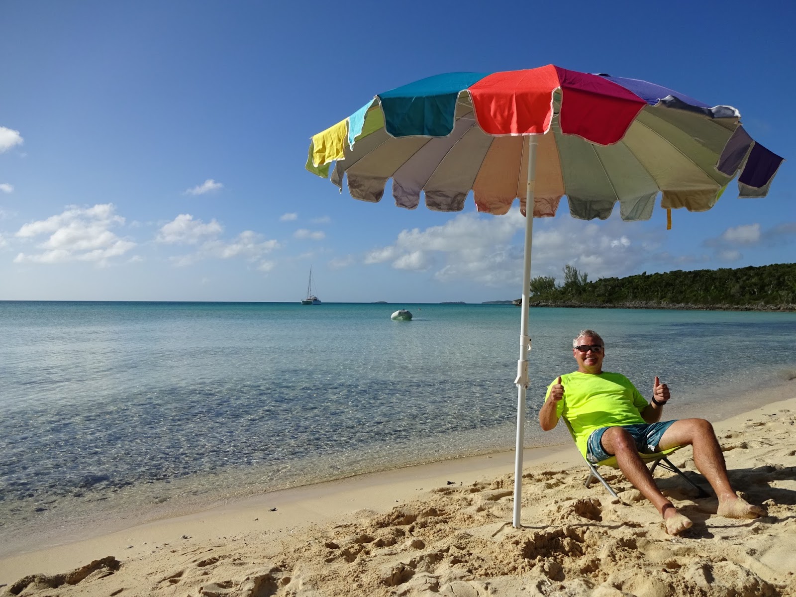
Ian enjoying the views, Stocking Island.


Low tide.


Anchorage on Western shore, Stocking Island. Zooropa is far left. Great Exuma Island in the background.


Stocking Island beach


Looking north up Stocking Island 


       As you can see from the number of pictures, we like the beach on Stocking Island!! We have been here a week now and I think we have walked it every day. This area ( Georgetown, Great Exuma ) is a really lovely place to hang out in. There are multiple, large anchorages, which is just as well since more and more boats are arriving daily. The busy little town has a well stocked grocery store, restaurants, gas station, marina, hair salons, etc, etc. There is a cruisers net on the VHF radio each morning to keep you informed of the daily events taking place. I have joined in with Yoga on the beach and and a fun water aerobic's class.  We have met up again with fellow Antares owners Greg and Sheila ( True North) and also Randy and Ellen ( Heaven) whom we last saw in Eleuthera.


    This is our last stop on The Exuma's. Tomorrow we will leave here and head south-east to Long Island, a pleasant day sail we hope!


Sunday, 17 January 2016

Eleuthera and a Weather Event.


Google Maps of Eleuthera


   On Sunday 27th December we left Harbour Island and made our way back thru the Devil's Backbone. Since we could follow our previous tracks  on our chart plotter we did not need the services of a pilot this time. We passed thru Spanish Wells again and then had a nice but short sail down to Current Cut.  The sails came down and the engines turned on to navigate thru this fairly narrow cut in the land. The current flowing thru this area can be quite strong and if it is flowing into opposing strong winds standing waves can result. Fortunately for us a larger catamaran was going thru ahead of us. We called him on the VHF radio and he informed us that there was up to a 5 knot current against the boat. We were able to gun the engines and made it thru ok.


Current Cut

     The next day was a special day for us, our 30th Wedding Anniversary.  We spent the morning doing boat chores, I baked a cake. In the afternoon we dinged to shore and walked across to the Eastern side of the Island. It was a rocky shoreline with impressive waves crashing in.


Happy Anniversary honey!


    South Palmetto and Ten Bay where two more stops on our way down the western shore of Eleuthera.

Ian relaxing on Ten Bay, Eleuthera

    Our next stop was Rock Sound Harbour.  We had read that it was a good anchorage and more importantly had a good grocery store. We needed to restock with fresh fruit and veggies etc before heading over to the Exuma's.

Rock Sound harbour


Main street in Rock Sound


     Finally here we found some cruisers!  There must have been about 10 boats in the anchorage, finally some human contact!!   We met up with Randy and Ellen whom we had originally met back in Deltaville and also met a lovely English couple, who's blog funnily enough is on my reading list.

    Rock Sound has a small settlement with a few shops and lots of abandoned buildings ( see building on left, above ). But the people are very friendly, there was a very nice restaurant near to the anchorage and more importantly, a liquor and good grocery store.  We spent four very pleasant days here.

   Cruisers that we have met are commenting on the unusual weather for this time of year in the Bahamas. There have been a lot of cold fronts coming off the US East coast  which impact the weather we experience here.  But on our third night at Rock Sound we experienced a weather event that our weather guru ( Chris Parker, Marine Weather Center) had never seen in his 13 years of weather forecasting.

  From Wikipedia; " A Derecho is a widespread, long-lived, straight-line wind storm that is associated with a land-based, fast moving group of severe thunderstorms. Can cause hurricane force winds, tornadoes, heavy rains, and flash floods".   If I had read that description before hand I would probably have abandoned ship!   In his daily report that we receive, Chris Parker had warned of possible squalls with high winds for later that night. So we were well prepared and everything on deck was well tied down. As the sun was setting there was a strange looking bank of clouds on the horizon. Shortly after sundown there was a sudden short and intense rain fall. Then, out of nowhere, the winds were howling.  We went from a calm sea to large waves in no time. It was suddenly like being on a bucking bronco at the local bar (  no, never been on one but have seen them in the movies, haha ).   We got our rain gear out, life jackets and flashlights ready. Ian stayed out at the helm in case he needed to start the engines. I sat inside praying that the anchor alarm on our phone ( we have an anchor app that would tell us if the anchor was dragging) wouldn't sound. For the first hour the wind was a sustained 40 to 45 knots ( 75 km/h) with gusts up to 53 knots. Thats 98 km/h!  Absolutely crazy! Our beautiful Rocna anchor held us tight thru it all.  In fact, it was buried so deep in the sand that it took some maneuvering to get it up 2 days later.  The next hour saw the winds drop to around 30 knots and then finally three hours later it was calm enough again to eat dinner.

   The next morning, talking to other cruisers, we learnt that several boats did have their anchors drag, one dingy and motor was capsized and one boat had it's genoa sail partially unfurl and then tear. Most sadly, one couple lost their dog overboard and he was found washed up on a beach the next morning.

  Two days later we were fully stocked up with groceries and headed out to the Exuma's. There was absolutely no wind at all that day and a beautiful calm sea. Ian got the fishing rod out but no luck.

  Our anchorage that night was between Allen's and Leaf Cay.  Leaf Cay has a small beach where people come, not to sunbathe, but to see the many prehistoric looking Iguanas.


Thank goodness they kept their distance.


a protected species here in the Bahamas


     Since then we have anchored at Norman's Cay ( famous for drug running in the '80's) and experienced our dingy fiasco at Shroud Cay ( see previous blog). We have spent the last three nights happily tied up to the dock at the marina on Highborne Cay. This is a private Island with a pleasant marina, fairly good grocery store ( food is high on our list of  importance) free use of their bikes and several long sandy beaches which are mostly empty of people. Looking ahead we had seen two particularly bad weather days with high winds from the West. The Exuma chain of Islands, running mostly North/South do not offer much protection from West winds so seeing that we were near by it made sense to come in and enjoy the protection of the marina.  We have had a very pleasant stay, lots of beach time and excellent burgers at the restaurant. Ian even got to watch the Packers defeat last night up at the bar!


A spectacular view.


Beach, north end of Highborne Cay


         We will be heading out and south tomorrow. Our next planned anchorage will be Hawksbill Cay.


Wednesday, 13 January 2016

The Height of Stupidity


 Yesterday we were anchored off Shroud Cay, a small Island in the Exuma's. It's claim to fame is the dingy ride that can be taken thru the large mangrove swamps- which make up most of the Island - to the opposite, Eastern, shore. I have certainly read and heard about this  and was keen to experience it myself.


 Due to some nasty looking clouds and squalls it wasn't until around 11am. that we set out. We weren't quite sure when high tide was but it looked to be around this time. We took a quick look at the chart which showed us the general direction of our route and off we went.

 It was very lovely riding along , surrounded by mangroves, not another person in sight. At times the water was quite shallow, a couple of feet, other times deeper, we could see the sandy bottom. We found our left turn easily, the "river" took it's left curve and then in the distance we could see the cut through land and out to the ocean. Our "river" now opened out into a large area and Ian mentioned that we should get our bearings for the return trip ( do you see where this is heading ).

 Well, we made it to the cut and the Eastern shore, beached the dingy and enjoyed a lovely long walk along an empty sandy beach. It was beautiful.

Looking out from the mangroves to the cut and the Eastern shore


 On our return to the dingy we noticed that the water was now flowing out through the land cut into the ocean at an excelerated rate, the tide was now going out.  We got the dingy back into the water,  started the engine and almost immediately, where as on our way in we had enough depth, the prop was now touching the sandy bottom. As we looked ahead at the large open area ( mentioned above) we could now see mangrove  shoots sticking up above the water that had not been visible when we had arrived. Obviously the tide was going out. Fast! We stopped the engine and both got out of the dingy. The water was up to our shins.  We walked ahead, pulling the dingy behind us, at this point there was enough water for it to float. Looking around, everything looked different and we realized that we could not tell where our "river" back to the boat was located.  I believe it was at this point that Ian commented that we had the combined IQ of a chipmunk!!  We had gone out into a mangrove swamp, there were no signposts out there and we had not brought along a GPS unit. The height of stupidity!!

 We knew the general direction we needed to go and so continued to walk along dragging the dingy behind us. But we could not find the deeper channel back anywhere, it was shallow all around us. As we continued on, searching for our "river" pulling the dingy got tougher as it was now bottoming out. Frequently as we walked along on the squishy sandy bottom we would suddenly sink down a deeper hole ( similar to walking thru snow drifts) and fall into the salty water.

 At some point we stopped, sat on the dingy, both pretty pooped by now, and our reality hit home. We were lost. The tide was still going out. The water was getting shallower. Next high tide would be in about 6 hours. It would be dark in about 4 hours. We had no flash light. No GPS. No VHF radio. No food. About a quarter bottle of water.

 Well. The thought of spending the night out there in our dink ( dingy) didn't appeal to me so I suggested we keep moving, somehow, anywhere was better than staying put.  We still had a general idea of which direction we needed to go. There was a small spit of land beside us which we felt we needed to get around so first we had to back track a little. We did that and then as we looked around, off in the distance ( not in the direction we thought we needed to go) I saw a break in the land and ocean, it was the Western shore, hallelujah !   It was not the opening thru which we had started our " adventure" but it would certainly do for our exit.

 We still had to drag the dingy, by now there were only inches of water, for about 400 yards. But at least now the end was in sight and we both worked hard, me pulling and Ian behind pushing that dingy until finally,  finally we reached water deep enough for it to float.

 We both fell into the dingy, found enough strength to pull the cord to start the engine and dingyed out of there and back to the mothership.

 Back on board Zooropa we were exhausted and seriously thirsty. Later that night the winds picked up and the temperatures dropped. It would have been a miserable night out.

 We have now made an extensive list of all equipment to consider before any dinghy excursion. I suppose the height of stupidity would be not learning from this experience.


Sunday, 27 December 2015

Junkanoo


We experienced our first Junkanoo last night here on Harbour Island. What a fun time. A Junkanoo is a Bahamian street parade with costumes, dance and music, usually held on Boxing Day. The time and effort that goes in to the making of the outfits and floats must be huge, they were just amazing. Apparently the floats, which are new each year, were made here on the Island.


 Look who else was enjoying the show. Greg Norman.  


Thursday, 24 December 2015

Where have all the sailboats gone?


 As we travelled down the US East Coast this Fall we were preceded and accompanied by hundreds of like minded cruisers all heading to points south in their boats.  Now, many will reach Florida and happily stay there for the winter. But that leaves many many more who will continue on to the Bahamas and beyond.  Where have they all gone?  We are now in the Eleuthera chain of Islands and I can count on one hand the number of cruising sailors we have seen.  Hopefully we shall run into more cruisers as we head south.


A Google Earth map of our route from Miami to Spanish Wells, Eleuthera


   When checking in to the Bahamas at Spanish Wells the customs officer actually wanted to see the boat, a first for us. So we tied up at the marina and then ended up staying there for several days. The officer didn't look around the boat at all, just came on board ( dirty shoes and all) filled out the forms, took our money and we were legal.

 Spanish Wells is a small community of about 1500 friendly people. As we walked around we were offered rides many times. The Island is small enough to be easily walked end to end but the roads are busy with locals riding their golf carts.

Spanish Wells harbour. Home to a large fleet of fishing vessels. 

Christmas in the Bahamas.


Spanish Wells 


Google Earth map of our route. Spanish Wells to Dunmore Town


  To reach Dunmore Town, Harbour Island, boats have to pick their way thru the reefs of the Devils Backbone.  The guide books all advise the hiring of a local captain for a safe transit. We took that advice.  At one point the route takes you within three hundred yards of the rocky shore, the waves crashing upon them. Closer than one normally likes to be in a boat with those sea conditions.!

 Dunmore Town is a delightful, busy town, originally the Capital of the Bahamas. A bit more "upscale" than Spanish Wells. A short walk across the Island takes us to the beautiful three mile long pink sand beach, fabulous for walking on especially at low tide.  Again, we have found ourselves mostly staying in a Marina. It is SO easy to be able to walk off the boat and not have to bother with a wet dingy ride. Other advantages to this Marina stay are the use of their fresh water pool and loungers and umbrellas at the beach.Who could resist !!  Oh well, once we leave here we will have to toughen up, back to life on the hook ( anchor) for us.


Main street, Dunmore Town


side street, Dunmore Town

local grocery store


we got a selfie stick!  On the beach.

  It's now Christmas Eve. I have spent the last hour working on this blog while Ian has been watching awfully bad movies!  We are missing both Samantha and Ryan this year. Next year you two. Somewhere hot and sunny!!    We will Skype with family tomorrow and then walk the beach. No turkey dinner but life is pretty good!  


Monday, 7 December 2015

Charleston to Miami

We left Beaufort, NC ( pronounced BO-fert) on Tuesday 10th November. It was a good sail thru the night in bumpy seas until the morning when the wind died and the engines came on. The seas died down quickly and we had a pleasant day motoring on calm seas. That night we were treated to an absolutely spectacular sunset. I was so busy enjoying it that I didn't think to take a picture, duh!!   Oh well.  We had an easy entrance into busy Charleston harbour and quickly got tied up at Charleston City Marina. We had come to Charleston mainly to switch out our mainsail. So that morning Ian and I got our old main down and the next day Jeff ( Antares) came to the boat and helped us get the new one up and properly adjusted. We couldn't have done without him. Many thanks to Jeff !!


Typical marshland scenery along the ICW, South Carolina 


 We spent a couple more days in Charleston, walking around the beautiful downtown, and then we were off heading down the ICW again to Beaufort, SC ( pronounced BU-fert).  We had some tense moments picking up a mooring ball in the downtown mooring field. I managed to get us attached first try but with the opposing wind and current Zooropa was swinging all over the place, with the mooring ball at times disappearing completely underneath us, not a good feeling. We were way too close to the other boats ( monohulls) near by and so decided to drop the ball and go anchor further out in the harbour.  We accomplished this and after ensuring that we were well stuck in we dingyed in and had a pleasant walk around the downtown area.


Beautiful Civil War era homes. Beaufort SC  


Large old trees covered in Spanish Moss. Downtown Beaufort, SC anchorage


   Our next stop was Hilton Head Island.  We spent a few days here at the Skull Creek Marina which was located within the Hilton Head Plantation, a large gated community with multiple golf courses and tennis courts.  We were able to borrow bikes ( no gears or brakes) and go for pleasant rides along the many bike paths.  Hilton Head is a busy Island with many cars but they have managed to keep the buildings well hidden behind the heavily treed landscape.

 We left Hilton Head on Monday 23rd November, heading outside for a two night sail to Fort Pierce, Florida, and hopefully some warmer weather. It was a chilly 4 degrees celsius the morning we left.  We had a rough and squally two night passage and were very glad to arrive at the Fort Pierce inlet at slack tide and have an easy ride in . It felt really good to get tied up at the Fort Pierce City Marina, especially as the winds continued to increase as the day went on. For the next few days we were completely pinned onto the dock.

  No problems though as we were busy visiting with friends from back home.  On Thursday Rebecca and Kent put on a delicious Thanksgiving dinner for fourteen of us, it was a fun evening in their lovely Florida home. Again, no pictures. What were we thinking!

first picture with selfie stick.  Kent and Rebecca with us on Zooropa. 


We had rented a car while at Fort Pierce so were able to get to Walmart, West Marine, Publix etc and stock up on lots of provisions.

 Another over nighter and we had made it to Miami, our last stop before heading over to the Bahamas.

Entering Miami Harbour


 We stayed at the Miamarina at Bayside in Miami. The marina is in need of repair but is ideally situated right downtown and an easy Uber ride ( my first, what a great idea!) to South Beach.  Samantha joined us here for a few days. We had a lovely visit with her as always but unfortunately the weather was rather wet!


Sammy at Muscle Beach, Lummus Park, South Beach. No rain but windy.


  It's now Monday December 7th.  Sammy left this morning and we had considered crossing over to the Bahamas but decided that the weather forecast wasn't ideal.  As of right now, it looks like a Wednesday crossing. We shall see.


Monday, 9 November 2015

Finally on our way South


Finally, we have left Deltaville and begun our trip south. We had a grey and windless day to travel down the Cheasapeake Bay to Norfolk but nonetheless it felt really good to be back out on the water. We anchored out in an anchorage on the Elizabeth River with the cities of Norfolk on one side and Portsmouth on the other.  Ian got the "rabbit ears" antennae out and was able to suck in a ton of TV stations. It was a Sunday night and guess who was playing? The Packers!! One happy Captain that night ( they suffered their first loss of the season though).

 Not so happy Captain the next morning when we couldn't get the anchor up. We would be travelling down the ICW and needed to time bridge openings and Canal lock throughs and had thought we had figured out a good schedule, so much for that. Forty five minutes later, after manoeuvring the boat this way and that way and then yanking sideways on the anchor chain suddenly the anchor was free and we were on our way.  By now we had thrown the schedule out the window. There was a bit of a panic approaching our first bridge ( an unattended railway bridge) when the boat immediately in front of us suddenly did a quick pivot around just as he was about to go under the bridge. He obviously thought that he couldn't fit under but he then backed through slowly and from my angle I could see that he in fact had lots of room so gave him the thumbs up. It always looks like a close call under the bridges from the deck of your own boat.

 Despite our later than planned start we did arrive at the perfect time to lock through at the Great Bridge Lock. Just as we pulled in the drizzle turned to full on heavy rain so we both got soaked as we got safely tied on in the lock. This single lock takes you up only 2 1/2 feet. It is a tidal guard lock which lifts boats up into the nearly 200 mile stretch of non-tidal waterway ahead.

 As we approached our next timed opening bridge we had about 10 minutes to wait so put the boat in neutral and very slowly drifted along. At some point I felt that we needed to centre ourselves more in the channel and gave a small spurt forward only to feel a gentle thud on the starboard side. Oooops! our first grounding of Zooropa. After taking soundings around the boat with the boat hook we realized it was only the starboard hull aground and with both engines in reverse we were able to get
ourselves off, and just in time to make the bridge opening !!

The end of this day on the waterways found us happily tied up to the dock in the small town of Coinjock, NC. Ahhhh. Heat on the boat, long hot showers on land and a delicious roast beef dinner at the local restaurant, does it get any better than that??


 After two more full days of motoring down the ICW, with nights spent out in very peaceful anchorages, we have finally made it to Beaufort, NC. We really like this little town ( we stayed here a few days in June on our way north) the docks are right downtown, there are lots of little shops and good restaurants and when staying here at the marina you get the free use of one of their old clunkers to make the run to the grocery store. We have met several other boats while here ( we are all waiting for the weather to shape up to continue south) so it has been quite social.  Today it is pouring buckets but tomorrow looks like a good day for us to leave. We hope to be heading off shore for what will be a two nighter to Charleston, but this all depends on what is happening with the Tropical Storm Kate, currently over the Bahamas.

  We are all set to go so we shall just wait and see what the weather gods bring us tomorrow. Hopefully the next post is from Charleston.